Reception for Amelia Earhart and Fred Noonan at Dakar, French West Africa. (Purdue University Libraries, Archives and Special Collections)
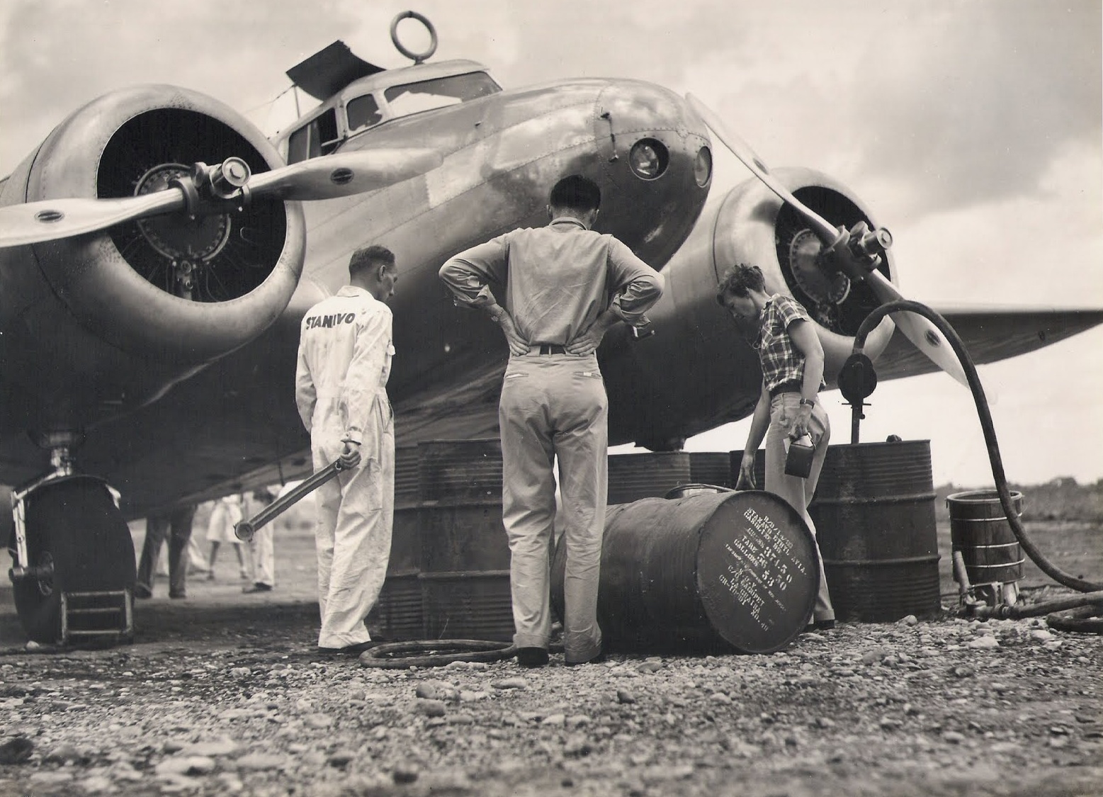
8 June 1937: Leg 11. After landing at Saint-Louis, French West Africa, the previous evening, Amelia Earhart and Fred Noonan reposition the Lockheed Electra 10E, NR16020, to Dakar, their intended destination. They lay over until 10 June for rest and maintenance on the airplane.
“On the morning of June 8 we flew the 163 miles from St. Louis. The chief reason I decided to lay over a day at Dakar instead of proceeding east was because my fuelmeter gave out two hours after we left Natal. The very efficient chief mechanic at Dakar discovered that a piece of the shaft was broken. While he worked on that – a difficult job to manage from a blueprint printed in English, which he did not understand, in an aeroplane he did not know – I had a forty-hour check of the engines, probably all they would need until we reached Karachi.”
—Amelia Earhart
Amelia Earhart’s Lockheed Electra 10E NR16020 being serviced at Dakar, French West Africa. (Purdue University Libraries, Archives and Special Collections)Straight line distance Saint-Louis to Dakar, French West Africa: 112.16 miles (180.5 kilometers). (Google Maps)
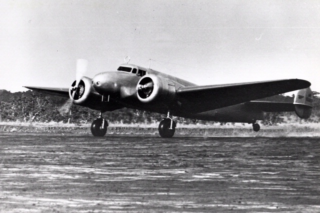
Photograph of a replica of Amelia Earhart’s Lockheed Electra 10E Special, NR16020, flown by Linda Finch. (Tony Bacewicz / The Hartford Courant)
7 June 1937: Leg 10—the South Atlantic Crossing. At 3:15 a.m., Amelia Earhart and Fred Noonan departed Natal, Brazil, aboard their Lockheed Electra 10E Special, NR16020, enroute across the South Atlantic Ocean to Dakar, Afrique occidentale française (now, Senegal).
It was 3.15 in the morning when we left Parnamirim Airport at Natal, Brazil. The take-off was in darkness. The longer runway, which has lights, was unavailable because a perverse wind blew exactly across it. So I used the secondary runway, whose surface is of grass. In the dark it was difficult even to find it, so Fred and I tramped its length with flashlights to learn what we could and establish something in the way of guiding landmarks, however shadowy. Withal, we got into the air easily. Once off the ground, a truly pitch dark encompassed us. However, the blackness of the night outside made all the more cheering the subdued lights of my cockpit, glowing on the instruments which showed the way through space as we headed east over the ocean. “The night is long that never finds the day,” and our night soon enough was day. I remembered, then, that this was my third dawn in flight over the Atlantic. . . .
— Amelia Earhart
Fred Noonan wrote in a letter from Dakar, “The flight from Natal, Brazil produced the worst weather we have experienced—heavy rain and dense cloud formations. . . .”
In her notes, Earhart wrote, “. . . Have never seen such rain. Props a blur in it. See nothing but rain now through wispy cloud. . . .”
— from Finding Amelia by Ric Gillespie, Naval Institute Press, 2006, Chapter 5 at page 41.
The poor weather made it impossible for Noonan to find their way across the ocean by celestial navigation, his field of expertise. Instead, he had to navigate by ded reckoning (short for deductive reckoning, not “dead”) and to estimate course corrections.
When they arrived over the African coastline at dusk, they knew that they were north of their intended course but haze caused very limited visibility. Navigational errors had caused them to miss Dakar, so they turned north until they came to Saint-Louis, where they landed after a 1,961 mile (3,156 kilometer), 13 hour, 22 minute flight.
Fred Noonan’s nautical chart for a portion of the Natal-to-Dakar flight in the Purdue University archives. (Gary LaPook, NavList)Great Circle route from Parnamirim Airport (NAT), Natal, Brazil, to Saint-Louis Airport ( XLS), Senegal, 1,721 nautical miles (1,981 statute miles/3,188 kilometers). (Great Circle Mapper)
Amelia Earhart and Fred Noonan at Natal, Brazil, 7 June 1937. (The Wichita Eagle)
6 June 1937: Leg 9. After a one-day layover at Fortaleza, Brazil, Amelia Earhart and Fred Noonan flew 267 miles (429 kilometers) to Natal and readied for their trans-Atlantic crossing the following day.
“We got into the air at 4:50 a.m. and arrived at Natal at 6:44, so our day’s work was done almost before conventional breakfast time. However, we had wanted to reach Natal early, on the chance we might start thence across the South Atlantic that evening.”
—Amelia Earhart
Straight line distance between Fortaleza and Natal, Brazil: 266.59 miles (429.04 kilometers). (Google Maps)
Chegando em Fortaleza com o capitão Noonan. (Fortaleza Nobre)
4 June 1937: On Leg 8 of their around-the-world flight, Amelia Earhart and her navigator, Fred Noonan, fly the Lockheed Electra 10E, NR16020, from Paramaribo, Nederlands Guiana (today, Suriname), to Fortaleza, Brazil, a distance of 1,330 miles (2,141 kilometers). They stay there to rest for a day.
“The weather at Paramaribo was perfect except for a morning mist from the Surinam River, when we took off to skim the tree-tops and then pull up. Speaking of trees, we had plenty of them on this jump to Fortaleza in Brazil – trees and water. During the day we flew over 960 miles of jungle, added to hops of 370 miles by compass course over open sea, a total of 1,330 miles, or a trifle more than half the transcontinental distance between New York and Los Angeles. . . After about ten hours’ flying I was glad to see Fortaleza sitting just where it should be, according to the maps, between the mountains and the sea, on a brown, sandy plain, in the arc of a crescent-shaped indentation just west of Cape Mucuripe. . . Fortaleza is a town of 100,000 people, a potent metropolis whose name few of us in North America have even heard. In my own ignorance I had thought of Natal as a more important place. That, of course, because Natal figures so largely in aviation matters. Fortaleza’s airport was so fine we decided to make final preparations for the South Atlantic hop there rather than at Natal, the actual jumping-off place for that much-flown stretch. . . .”
—Amelia Earhart
Amelia Earhart’s Lockheed L-10E Electra NR16020 at Fortaleza, Brazil. (Fortaleza Nobre)Great Circle route from Paramaribo, Suriname, to Fortaleza, Brazil, 1,142 nautical miles (1,314 statute miles/2,114 kilometers). (Great Circle Mapper)
Amelia Earhart supervises refueling her Lockheed Electra 10E, NR16020, at Caripito, Venezuela. (Unattributed)
3 June 1937: Leg 7. Amelia flew her Electra from Caripito, Venezuela, to Paramaribo, Nederlands Guiana, a distance of 615 miles (990 kilometers). She arrived at 12:50 p.m., local time.
Amelia Earhart boards her Lockheed Electra 10E NR16020 at Caripito, Venezuela, 3 June 1937. (Unattributed)
Rain clouds hung thick about Caripito as we left on the morning of June third. We flew over jungles to the coast, and then played hide-and-seek with showers until I decided I had better forgo the scenery, such as it was, and climb up through the clouds into fair weather. An altitude of 5,000 feet topped all but the highest woolly pinnacles. . . Soon we saw the river Surinam, a silver streak meandering to the coast, a wide tidal stream full of floating green islands of small trees and water plants, and bordered with vast stretches of mud. Twelve miles from its mouth is Paramaribo, capital of Dutch Guiana, and twenty-five miles further inland the airport. . . No make-shift airport this, but one of the best natural landing areas I have ever seen. . . .
—Amelia Earhart
Amelia Earhart’s Lockheed Electra 10E, NR16020, departs Caripito for Paramaribo, 3 June 1937. (Purdue University Libraries, Archives and Special Collections)Amelia Earhart and Fred Noonan arrive at Paramaribo, Dutch Guiana, 3 June 1937. (Stichting Surinaams Museum)Great Circle route from Maturin, Venezuela, the closest existing airport to Caripito, to Paramaribo, Suriname: 539 nautical miles (621 statute miles/999 kilometers). (Great Circle Mapper)
")

")